Welcome to the final instalment of our blog series showcasing Open Data Manchester’s decade of data-driven change. In this series, we’ve explored eight case studies that demonstrate the real-world impact of our projects.
Today, we’re concluding with our ‘Mapping Mobility Stockport’ project, a collaborative effort to improve accessibility in urban spaces.
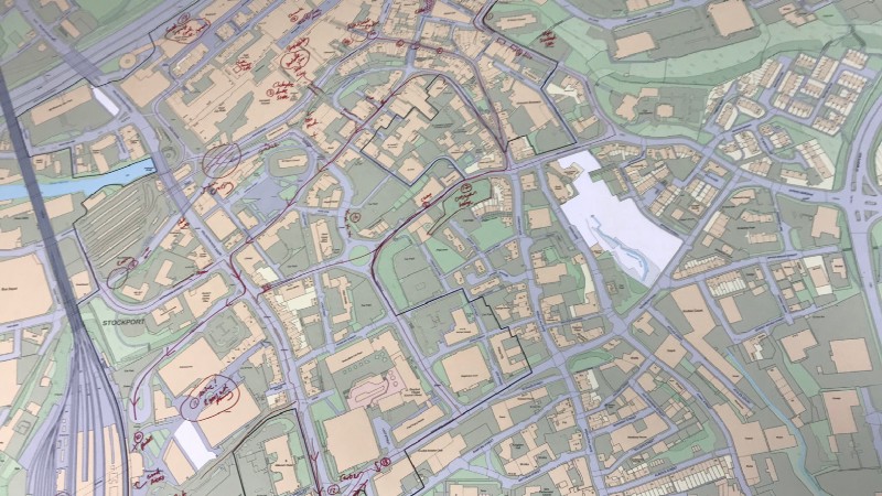
Mapping Mobility Stockport: Data-Driven Approaches to Urban Inclusivity
Towns and cities often include barriers that exclude people with restricted mobility. The aim of this project was to create a mobility map of Stockport town centre that reflected the real experiences of people with impairments, who are often experts in negotiating urban obstacles.
Our Participatory Approach
Open Data Manchester partnered with Stockport Council, Disability Stockport, and Age UK Stockport on this project. Our methodology included:
- Co-design workshops: We collaboratively designed a series of workshops and outdoor mapping expeditions;
- Joy Diversion adaptation: We based our approach on Open Data Manchester’s Joy Diversion meetups, adapting them for accessibility mapping;
- Community engagement: We involved people with diverse mobility needs in the mapping process;
- Geospatial data collection: We crowdsourced data on regularly used routes, obstacles, and effective solutions;
- Data analysis: We analysed the collected data to identify patterns and areas for improvement.
Our approach put the experiences of people with restricted mobility at the centre of the mapping process.
Key Outcomes
Our project resulted in several significant outcomes:
- Development of a methodology for quickly and ethically crowdsourcing mobility data.
- Creation of a mobility map of Stockport town centre.
- Identification of permanent fixtures (e.g., road width, incline, street furniture) that impact mobility.
- Insights into the limitations of current mapping technologies for accessibility.
- Groundwork for developing more inclusive mapping standards.
Impact
The Mapping Mobility project has provided valuable insights into creating more inclusive urban spaces. As noted in our case study:
“The Mapping Mobility project served as a strong pilot for a methodology that can quickly and ethically crowdsource this data — and the OpenStreetMap community is one that is in the best position to push this in the right direction.”
The project has not only produced practical data for improving Stockport’s accessibility but also highlighted the need for more inclusive approaches to urban mapping and planning.
Looking Ahead
This project demonstrates the power of community-led, participatory approaches in addressing urban accessibility challenges. As cities strive to become more inclusive, methodologies like this will be crucial in ensuring that diverse mobility needs are considered in urban planning and design.
The insights gained from this project informed further work, including the Right to the Streets project, in which we developed a community-led Place Review tool as part of a wider initiative to create safer and more welcoming streets and public spaces in North Trafford, with a focus on tackling gender-based violence and harassment.
Read more posts in this series, where we explore more impactful ODM projects. Together, these case studies showcase our commitment to using data and user research for positive change and building a more informed, ethical, and data-empowered future.
If you want to learn more about how ODM can support your organisation’s data strategy, get in touch.