This four-part blog series explores Open Data Manchester’s approach to community-led data collection, showcasing our methodology and impact across various projects.
Part 3: Participatory Mapping – From Joy Diversion to Focused Applications
The evolution of our mapping approach
Over the years, we’ve developed an approach to participatory mapping that has evolved from playful urban exploration to targeted community-led research. This journey illustrates how methodology can adapt to different community needs while maintaining core principles of engagement and empowerment.
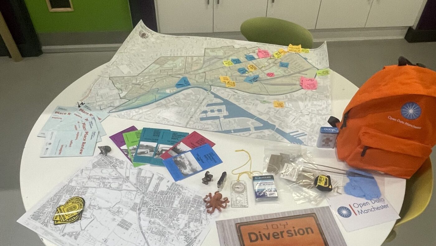
Joy Diversion: where it begain
In May 2018, we launched Joy Diversion – a celebration of joyful meandering through Manchester and Salford. This wasn’t a guided tour but an adventure, inviting explorers to make their own discoveries using historical maps from the 1800s.
At its heart, Joy Diversion challenges the commodification of urban space. Participants venture out, find and map points of interest, then return to share their findings. This approach – combining historical context, physical exploration, and communal sharing – created a powerful foundation that we’ve since adapted for more focused projects. (You can read more about Joy Diversion in our recent blog post).
From exploration to inclusive research
Mapping Mobility Stockport (2018)
Our first targeted application of this methodology came with Mapping Mobility Stockport, a partnership with Stockport Council, Disability Stockport, and Age UK Stockport. The project aimed to create a mobility map of Stockport town centre by crowdsourcing data about accessibility from those who navigate these spaces daily.
We co-designed workshops and outdoor mapping expeditions based on the Joy Diversion model but adapted for mobility considerations. The project yielded insights that went beyond our initial expectations, revealing how standard mapping approaches often fail to capture crucial accessibility factors like inclines, pavement widths, and obstacles.
As one participant noted during a mapping session, “What you see as a minor inconvenience is a complete blocker for me.”
This project demonstrated how community mapping could challenge conventional frameworks for understanding urban spaces. Rather than simply recording what exists, it questioned what should be considered important enough to map in the first place.
Read the full Mapping Mobility Stockport case study.
Right to the Streets (2022-2023)
Our participatory mapping approach evolved further with Right to the Streets, a year-long project addressing gender-based violence and safety in North Trafford’s public spaces. Part of a larger Home Office Safer Streets Fund initiative, this project brought together several partners and community organisations.
Our initial plan was to conduct walkabouts to identify routes and locations for a formal place audit. However, engagement with the community led us in a different direction. Instead of using a pre-existing audit tool, we co-created a new Place Review tool with the community, using their own language, priorities, and insights.
Our methodology included:
- Community surveys and 14 walkabout workshops with over 50 participants
- Mapping exercises where participants marked routes, areas of concern, and their feelings
- Development of a Place Review tool based on recurring themes and community language
- Feedback sessions and usability testing
The project revealed important insights about women’s and girls’ experiences in public spaces, including issues with street lighting, pavement conditions, and anti-social behaviour. It also highlighted the importance of parks and green spaces for fostering community connection.
“[The Place Review was] eye opening,” reflected one participant. “I come through the area everyday but don’t assess it apart from feelings.”
The resulting Place Review tool represents an alternative to traditional urban assessment methods by placing affected communities at its heart. It enables residents to conduct their own audits and turn insights into action.
Read the full Right to the Streets case study.
Key lessons from our mapping journey
The evolution from Joy Diversion to targeted projects like Mapping Mobility and Right to the Streets has taught us valuable lessons about community-led data collection:
- Physical presence transforms understanding: Walking and experiencing spaces together creates insights that are difficult to achieve through other methods. The act of moving through a space together changes how people relate to it and to each other.
- Experiential knowledge is invaluable: Those who navigate spaces with different needs – whether mobility restrictions or safety concerns – hold knowledge that is essential for inclusive planning and cannot be replicated by outside observers.
- Co-creation surpasses consultation: Moving beyond gathering feedback to actually designing tools and frameworks with communities leads to more relevant, accessible, and impactful outcomes.
- Language and framing matter: Using community members’ own terminology rather than imposed technical language creates more accessible tools and validates lived experience.
Eve Holt, Strategic Director at GM Moving, observed this impact in Right to the Streets:
“Through the community walkabouts and careful design of the place audit, we were able to gather data and insight together in a way that felt generative, increasing people’s connections to each other and pride in their neighbourhood. This was an important and welcome departure from more extractive and deficit focused processes.”
From mapping to measuring
These participatory mapping projects have fundamentally shaped our approach to community data collection, continuing to influence how we work with communities today. The methodology we’ve developed – from joyful exploration to structured co-creation – now informs our broader Data For Communities programme and our vision for community-led data initiatives.
In the final blog of this series, we’ll explore how these foundations came together in Our Streets Chorlton and the development of our Data Champions model – a different approach that empowered community members to collect and interpret quantitative environmental data.
By sharing these evolving approaches, we hope to inspire other communities and organisations to develop their own methods of connecting people, places, and data in ways that lead to meaningful change. If you’re interested in learning more about our participatory mapping approaches or discussing how similar methods might work in your community, we’d love to hear from you.